
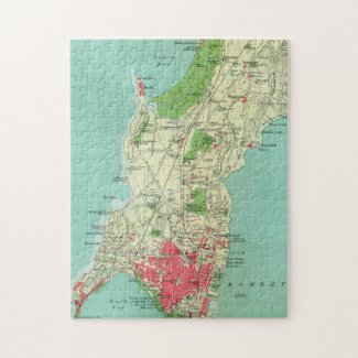
Before Mumbai became the bustling metropolis we know today, it was called Bombay—a city shaped by centuries of colonial rule, maritime trade, and cultural convergence. This vintage map, believed to date back to the early 20th century (possibly the 1930s), captures the city during its British colonial era, when the streets were named after governors, and Victoria Terminus stood as a proud symbol of Indo-Gothic architecture.
With beautifully shaded greens for open spaces and bold reds for urban centers, the map reflects Bombay as a growing hub of commerce and culture. It’s a visual journey into the past—one that history buffs, geography lovers, and nostalgic travelers can appreciate.
Whether you've walked the streets of present-day Mumbai or just dream of visiting, this puzzle lets you piece together a moment in time that shaped the India we know today.
No comments:
Post a Comment